
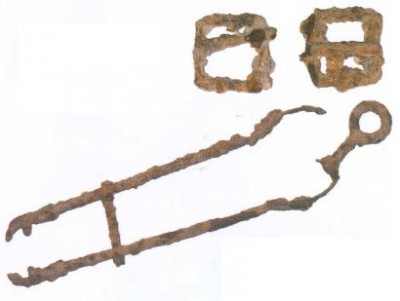
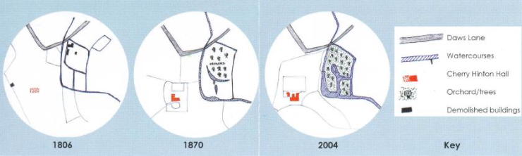
 There are several indications that suggest a water mill site in the grounds of Cherry Hinton Hall. The Doomsday book mentioned 4 mills in Cherry Hinton which would have been water-powered. The southern end of Cherry Hinton village was known as Mill End. The watercourses in the park are manmade and take water from Cherry Hinton brook to form possible ‘Ieats’ or head water for powering a water mill. The enclosure map of 1806 shows these watercourses and 3 buildings positioned next to them, which may have been the mills. Mill stones have also been found here.
 The archaeological investigation of the possible watermill site at Cherry Hinton Hall consisted of four one metre square trenches or test pits. The archaeology in progress These trenches were excavated according to archaeological methods, recording the position and depth of any finds and excavated materials. The position of the test pits were calculated to uncover evidence for the buildings shown on the enclosure map of 1806. These buildings were demolished when the estate was purchased and developed after 1830. The parallel watercourses were remodelled into ornamental fish ponds, surrounded by orchards, shown on the sale map of the estate from 1870.
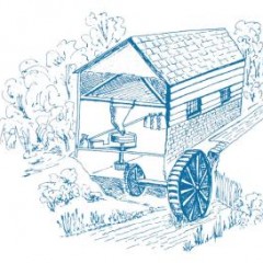
 The excavations provided evidence for one or more watermills on this site. In fact, a number of different mills may have stood here over the centuries in different positions and of differing construction. They may have been made of clunch (a type of chalk) and brick with a compacted chalk floor, and a tiled roof. The earliest millstones may have used a horizontal waterwheel positioned in the water flow. The sketch shows a typical later mill with a vertical waterwheel. One of the test pits uncovered a stone conduit or water channel, which may have been part of a mill.
Copywrite – Michelle Bullivant